
WELLNESS HUB

XpatAthens
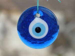
The Power Of The Evil Eye
ACS Youth-to-Youth Educational & Social Integration Progams Ceremony 2018-2019

The Youth-to-Youth Programs are delivered by ACS Athens to unaccompanied refugee minors in collaboration with The HOME Project Organization, with the generous support of the Shapiro Foundation and IKEA Foundation. This academic year is the third year that the part-time and full-time Youth-to-Youth Programs are running, proving in action how educational institutions have the power to respond to the deep problems of today’s world and find reliable partners to do so.
For all participating students and faculty members, this event was a celebration of a year full of knowledge and friendships, a touching celebration of life moving forward. The students shared their experiences from being a part of the Youth-to-Youth programs, either as students or as volunteer teachers, both sides expressing the same thought: “we learned from each other, we learned from each other’s culture and history, we are friends for life.”
Performing dances, singing and smiling, the students shared their talents, dreams, and future aspirations together with their dedication to keeping up their hard work for their next steps in education.
The Director of Youth-to-Youth Educational and Social Integration Programs and Academy Vice Principal, Ms. Julia Tokatlidou hosted the ceremony and proudly introduced the exceptional young participants of the program, some of whom have started only a few months ago but are already part of the ACS Athens family.
The Youth-to-Youth Programs will continue making an impact and will keep growing. For the academic year 2019-2020, the Shapiro Foundation has granted 18 full-time scholarships in ACS Athens for the HOME Project children, securing the opportunity to continue their studies at a leading educational institution
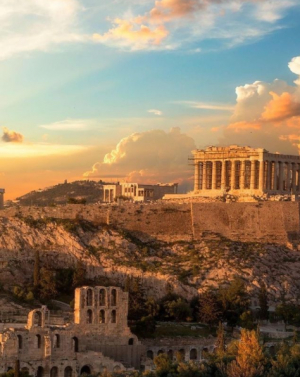
November 12 - ATHENS: Moving Forward
The Atrium - A New Secret Garden At The Hotel Grande Bretagne
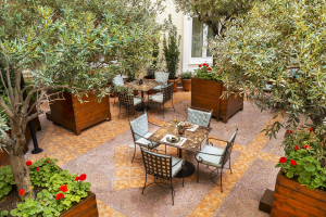
Telephone: 210 3330748
Click HERE to explore the delicious menu!
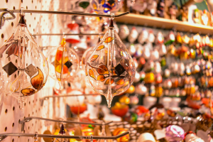
Sharing Culture
Sharing it widens the mind and spirit!
Exploring The Greek Panigiri: Tradition, Celebration & Famous August Festivals
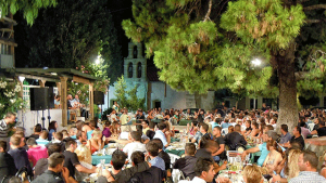
What is a Panigiri?
A panigiri is much more than just a festival; it is a community gathering that encompasses religious rituals, music, dance, food, and social bonding. Typically hosted by villages or towns, these festivals are often centered around a church or chapel dedicated to a saint. The celebration usually begins with a religious service, followed by communal feasting, traditional music and dancing, and various local customs that have been passed down through generations.
Key Elements of a Panigiri
- Religious Ceremonies: The day usually starts with a church service or a procession where the icon of the saint is paraded through the village streets. This is a moment of profound spiritual significance, bringing the community together in prayer and reverence.
- Music & Dance: Traditional Greek music, often featuring instruments like the bouzouki and the lyra, plays a central role. Dance is equally important, with people of all ages joining in dances such as the syrtaki and kalamatianos, which often last until the early hours of the morning.
- Food & Drink: No panigiri is complete without an abundance of local delicacies. Souvlaki, grilled meats, fresh salads, and pastries are common, accompanied by local wines, ouzo, or raki.
- Games & Activities: Depending on the region, there might be various traditional games and activities, including tug-of-war, sack races, and even animal contests in some rural areas.
August is a significant month for panigiria in Greece, largely due to the Assumption of the Virgin Mary on August 15th, one of the most important religious holidays in the country. Here are some of the most renowned panigiria held in August:
Tinos: The island of Tinos hosts one of the most famous panigiria on August 15th. The Church of Panagia Evangelistria becomes the focal point for thousands of pilgrims who arrive to pay their respects, seek blessings, and participate in the grand celebrations.
Ikaria: Known for its exuberant festivals, Ikaria's panigiria are legendary. The panigiri in the village of Christos Raches on August 6th (Transfiguration of the Savior) and August 15th are particularly notable for their lively atmosphere, featuring traditional Ikarian music, dance, and feasts that go on until dawn.
Paros: The island of Paros celebrates the Assumption of the Virgin Mary with a grand panigiri in the town of Parikia. The Church of Panagia Ekatontapiliani (Our Lady of the Hundred Doors) becomes the center of festivities, including processions, fireworks, and traditional music and dance.
Nisyros: This small volcanic island hosts a unique panigiri on August 15th at the Monastery of Panagia Spiliani. The celebration includes a blend of religious devotion, local music, dance, and feasting, attracting visitors from nearby islands and beyond.
Sifnos: On August 14th, the village of Apollonia on Sifnos holds a vibrant panigiri to honor the Dormition of the Virgin Mary. The festivities include a litany, traditional music, and dances that reflect the island’s rich cultural heritage.
The Greek panigiri is a testament to the enduring cultural and religious traditions that continue to thrive in Greece.
These festivals are a celebration of community, faith, and heritage, offering a unique glimpse into the heart and soul of Greek life. Whether it's the solemnity of the religious ceremonies, the joy of the communal dances, or the flavors of the local cuisine, panigiria in August provide an unforgettable experience that draws people together in a shared celebration of life and tradition.
Empowering Kids: Nurturing A Love Of Reading In Today's Digital Age

Originally published in Greek on: loveyourselfmagazine.com

Love Yourself is a comprehensive Greek media platform dedicated to embracing mindstyle as its fundamental essence. It advocates for a wholesome lifestyle that nurtures not only our soul, mind, and body but also promotes a positive and sustainable attitude towards the planet we call home. For more information, visit Love Yourself's website!
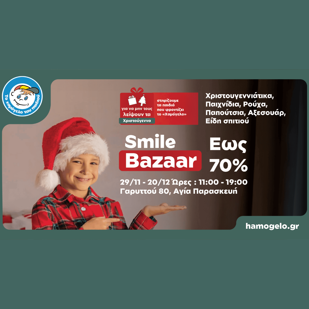
2024 Athens Christmas Bazaars
📍 Garitou 80, Agia Paraskevi, 5th Floor
🕒 11:00 AM – 7:00 PM
Support "The Smile of the Child" by shopping for branded clothing, toys, accessories, and Christmas items with discounts up to 70%. Every purchase contributes to their efforts to support children in need.
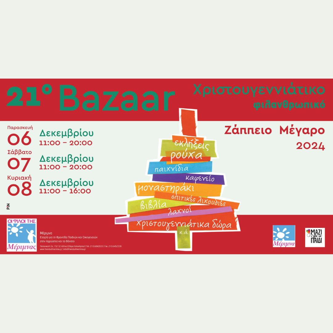
📍 Zappeion Hall
🕒 6-7 December: 11:00 PM – 8:00 PM; 8 December: 11:00 AM – 4:00 PM
Enjoy surprises, handmade crafts, books, and festive gifts. Indulge in delicious homemade treats at the bazaar’s café and participate in raffles for exciting prizes.
📍 Old Railway Station, Markopoulo
🕒 12:00 PM – 8:00 PM
Discover sustainable art and crafts made from recycled materials, natural cosmetics, woven and knitted items, and handmade jewelry. A perfect place to find unique gifts with a creative touch.
📍 Thoukididou 9, Plaka
🕒 10:00 AM – 5:00 PM
Known as the most popular school fair in Plaka, this event offers handcrafted gifts, gingerbread houses, live music, and a raffle. Proceeds benefit the FEA - Filodasiki Enosis Athinon and the Cerebral Palsy Greece/Open Door.
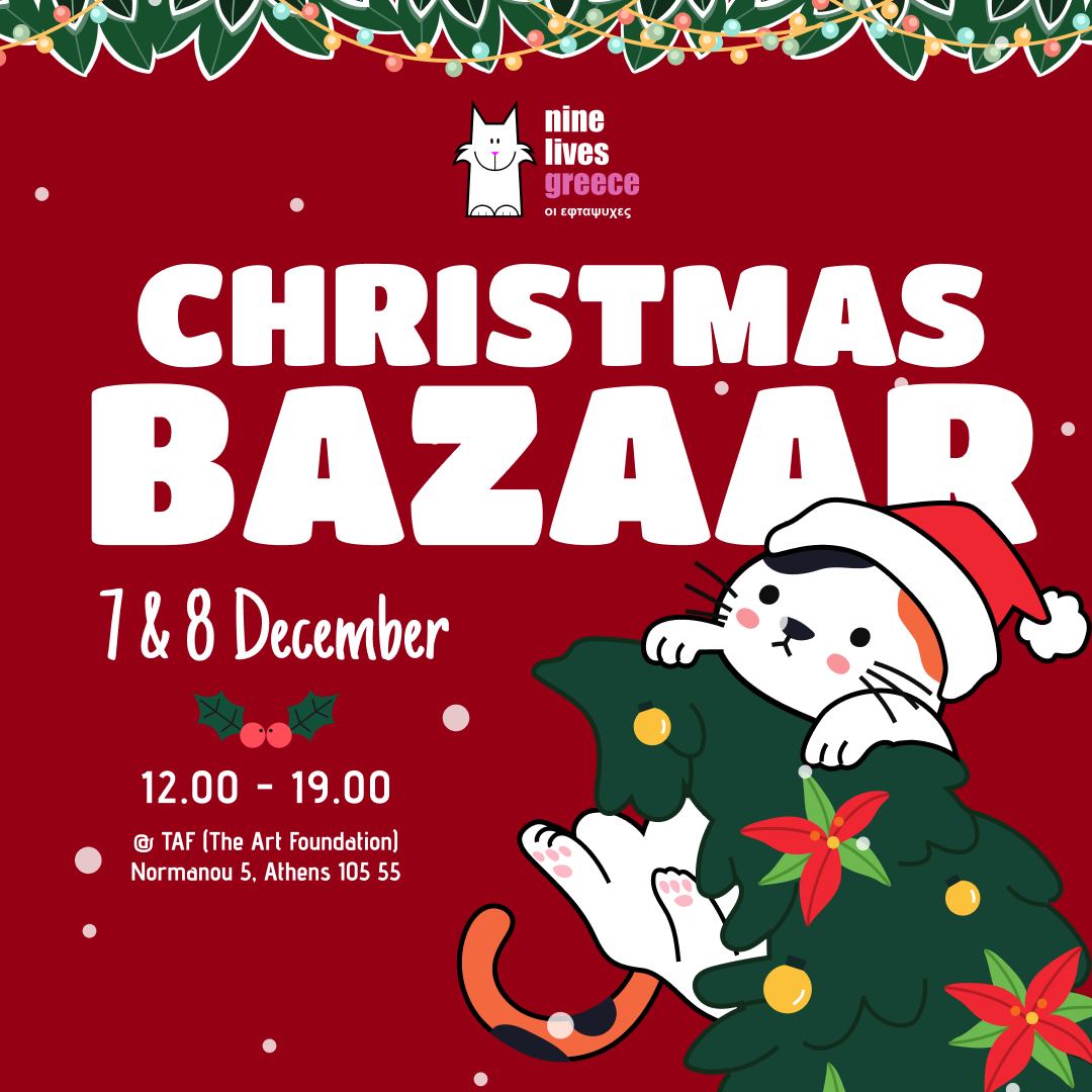
📍 TAF – The Art Foundation, Normanou 5, Athens
🕒 12:00 PM – 7:00 PM
Celebrate the season and support stray cats at the Nine Lives Greece Christmas Bazaar. Discover unique holiday gift ideas while connecting with fellow cat enthusiasts. From festive decorations to handcrafted items, this bazaar offers something special for everyone, with all proceeds aiding stray cat care and rescue efforts.
📍 Inter-School Center of Glyfada Municipality, Epanminonda 30
🕒 10:00 AM – 5:00 PM
Shop for homemade sweets, books, and SPAZ merchandise like hoodies, mugs, and their 2025 calendar. Don’t miss the lottery with amazing prizes.

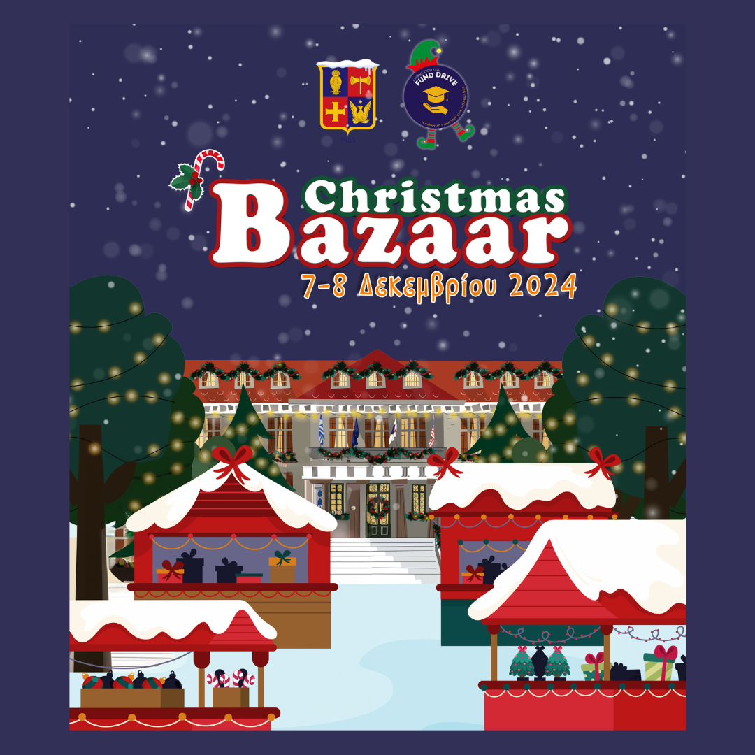
📍 Stefanou Delta 15, Filothei
🕒 10:00 AM – 6:00 PM
Support education and philanthropy at this official Christmas bazaar organized by the Parents’ Committees and Alumni Parents’ Fund Drive of Athens College. Browse a wide selection of festive gifts, handmade crafts, and more, with all proceeds going to the school's Scholarship Program. This is a wonderful opportunity to combine holiday shopping with supporting a meaningful cause.
📍 Event Hall of the Former PIKPA, Old Penteli
🕒 10:00 AM – 5:00 PM
Support the Penteli Children’s Recovery Volunteers by shopping for handmade creations, delicious treats, and thoughtful gifts for loved ones. Every purchase helps contribute to their ongoing charitable efforts.
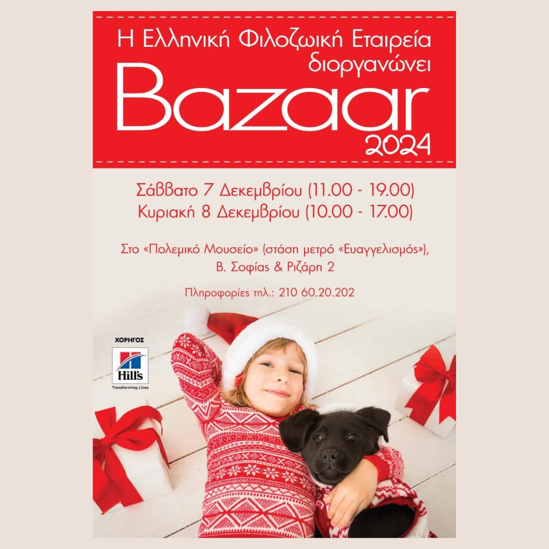
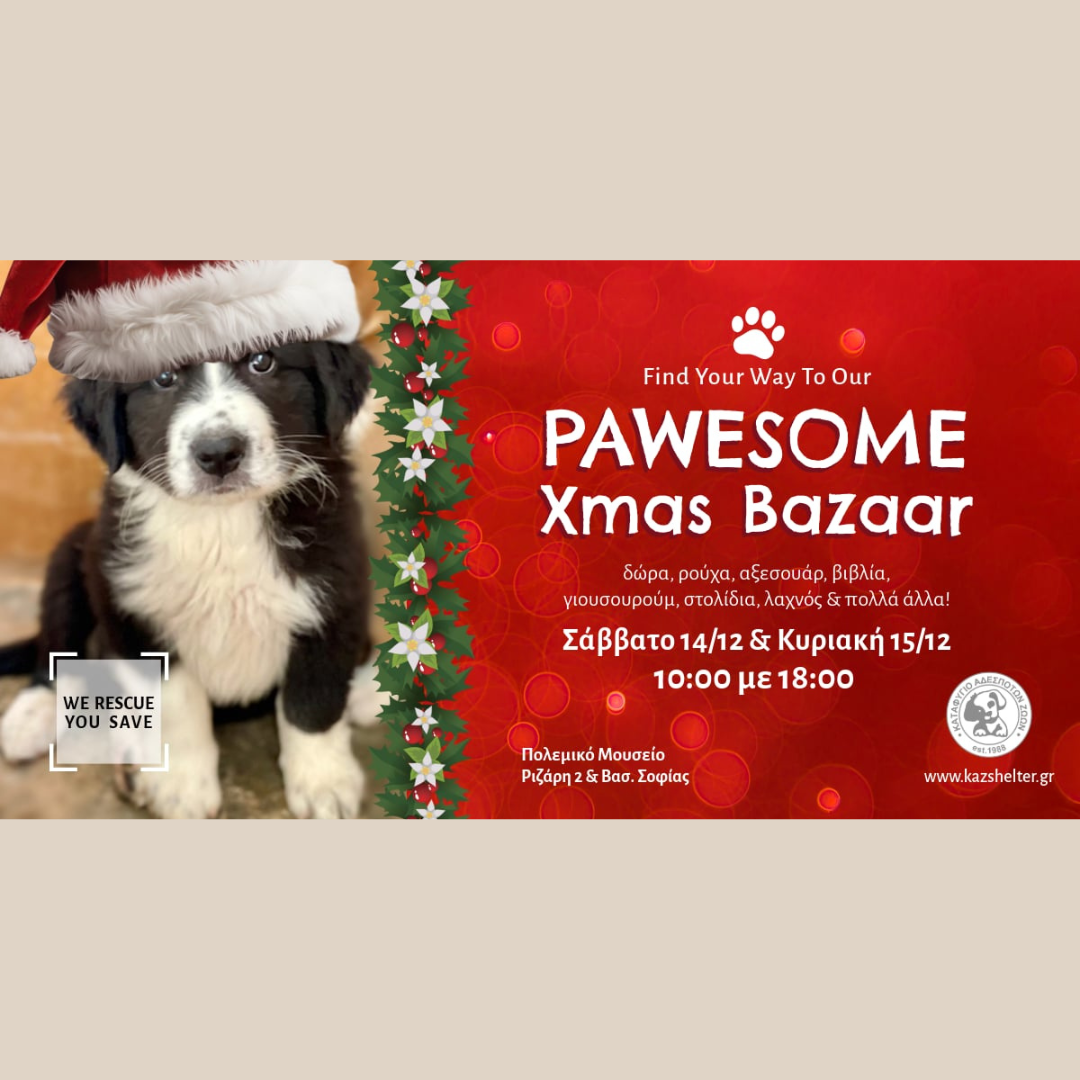
📍 War Museum, Rizari 2, Athens
🕒 7 December: 11:00 AM – 7:00 PM; 8 December: 10:00 AM – 5:00 PM
Find brand-new items donated by sponsors, including clothing, accessories, and unique holiday gifts. Perfect for animal lovers, this bazaar combines festive shopping with a great cause.
📍 Italian School of Athens, Mitsaki 18, Ano Patisia
🕒 7 December: 10:30 AM – 6:00 PM; 8 December: 10:30 AM – 4:00 PM
Step into a little slice of Italy with authentic Italian pizza, panini, traditional sweets, cheeses, wines, panettone, and more. Don’t miss the raffle for a chance to win delightful Italian treasures.
📍 3rd September Street 56, Athens, 1st Floor
🕒 10:00 AM – 6:00 PM
Experience a blend of Greek and Egyptian culture at this unique market featuring handmade crafts, Christmas decorations, Egyptian-style jewelry, books, and traditional sweets. The market also includes exciting raffles with immediate and grand prizes—don’t miss the chance to meet the Patriarch of Alexandria!

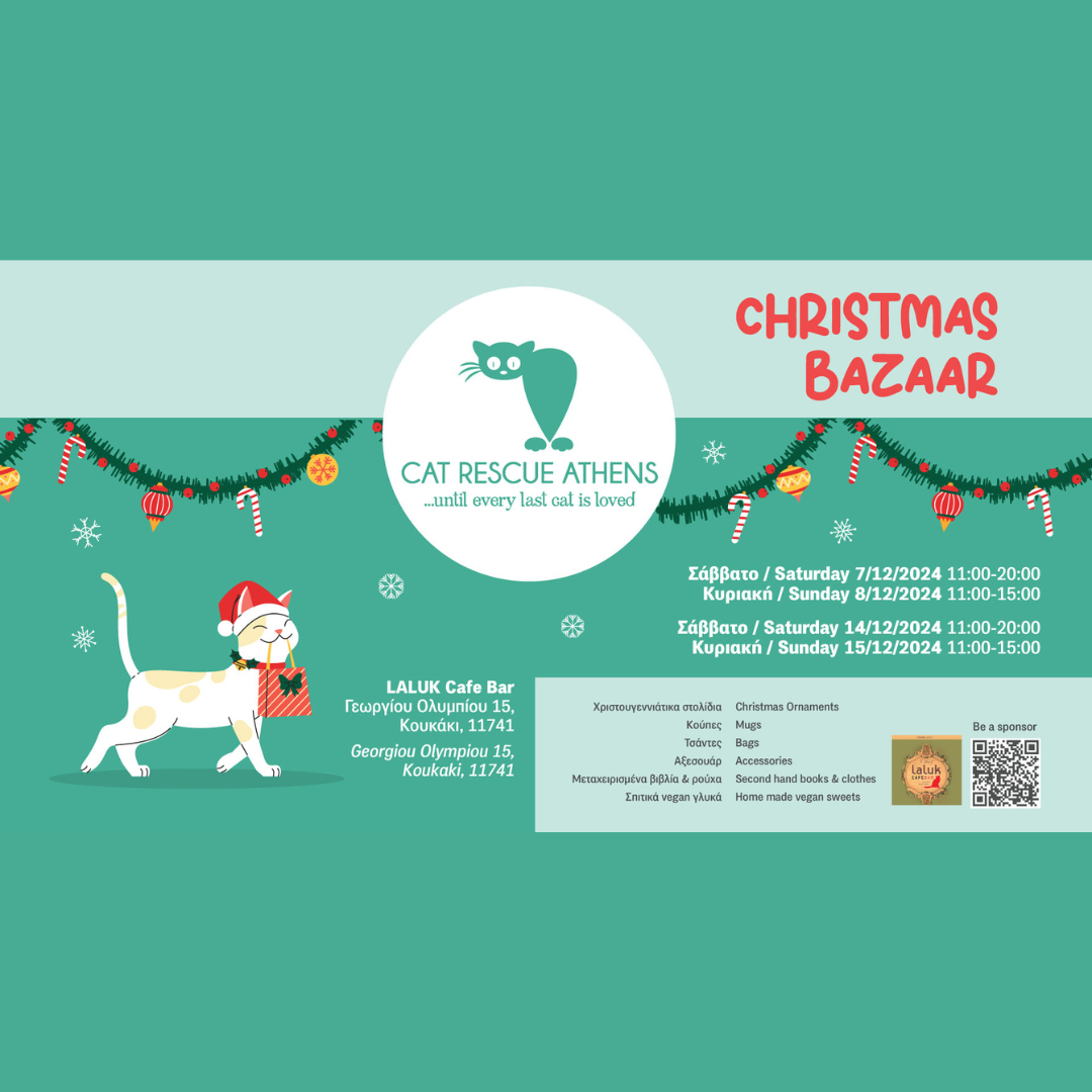
📍 Laluk All Day Bar, Georgiou Olympiou 15, Koukaki
🕒 Saturdays: 11:00 AM – 8:00 PM; Sundays: 11:00 AM – 3:00 PM
Join this heartwarming Christmas bazaar hosted in the cozy, animal-friendly Laluk café, surrounded by adorable resident cats. Enjoy coffee, reconnect with friends, or meet fellow supporters of Cat Rescue Athens while shopping for handmade ornaments, jewelry, accessories, second-hand books, and homemade sweets. Don’t miss their signature mugs, tote bags, and exclusive t-shirts designed by talented artists. All proceeds support medical care, food, sterilization, and rescue operations for stray cats in need.
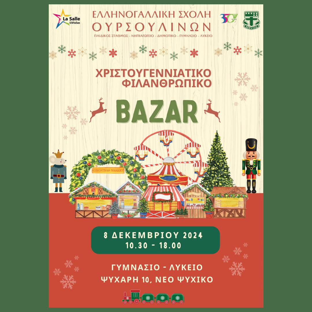
📍 Psychari 10, Neo Psychiko
🕒 12:00 PM – 6:00 PM
Celebrate the holidays with an array of festive activities and treats, including a treasure hunt, a raffle, handmade crafts, and a variety of delicious sweet and savory delights. The event also features games, a mini amusement park, and creative workshops—a perfect outing for the whole family.
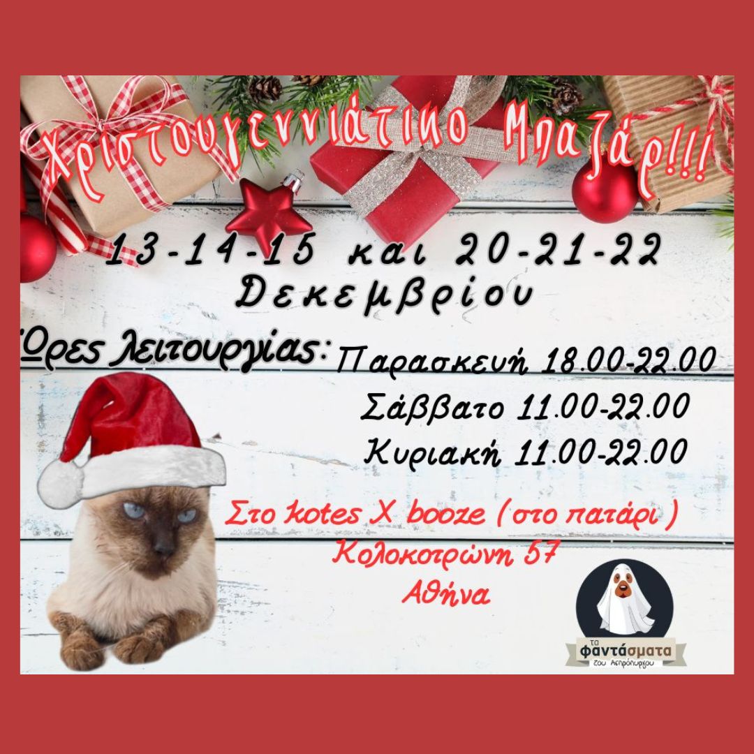
📍 KOTES X-Booze, Kolokotroni 57, Monastiraki
🕒 11:00 AM – 10:00 PM
This heartwarming bazaar aims to support stray animals in Aspropyrgos living in dire conditions. Explore an assortment of unique gifts donated from across Attica, including decorations, accessories, and handmade items. Enjoy the festive atmosphere while contributing to a vital cause that helps rescue and care for these animals.
📍 Dimitriou Panagea Street, Pallini
🕒 13 December: 5:00 PM – 9:00 PM; 14-15 December: 9:00 AM – 9:00 PM
Immerse yourself in a festive atmosphere featuring gifts, ornaments, books, and traditional Greek and German treats. Children’s Christmas performances add a magical touch to this event, perfect for the whole family.
📍 War Museum, Rizari 2, Athens
🕒 10:00 AM – 6:00 PM
Support stray animals by purchasing handmade crafts, curated ornaments, and gifts at this heartwarming bazaar. With a raffle where one in two wins, this event combines charity with festive fun.

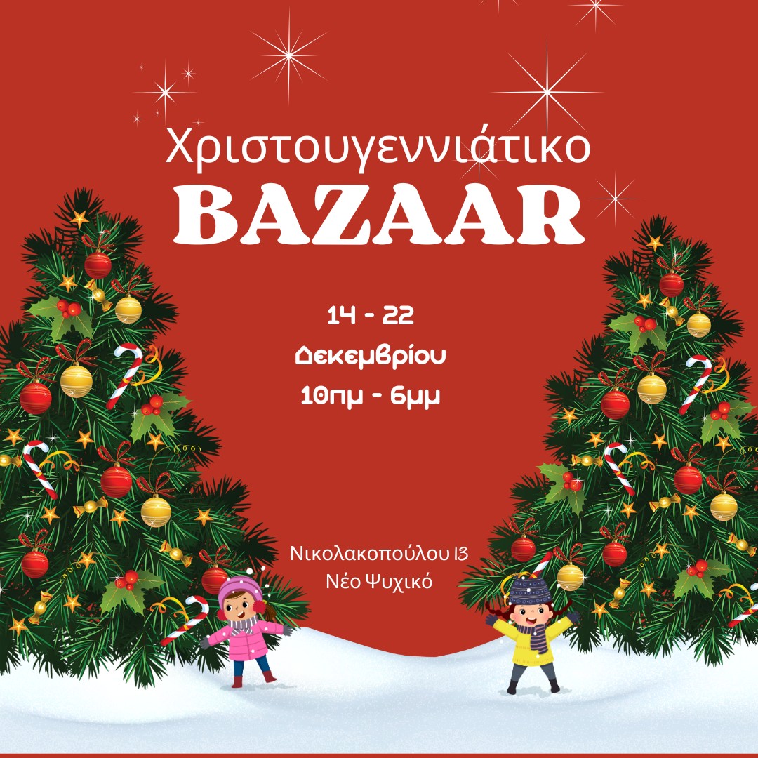
📍 Sonias Nikolakopoulou 13, Neo Psychiko
🕒 10:00 AM – 8:00 PM
Explore an array of gifts and handmade crafts created by individuals at the center. This week-long market not only offers meaningful shopping but also provides vital support to those in need.
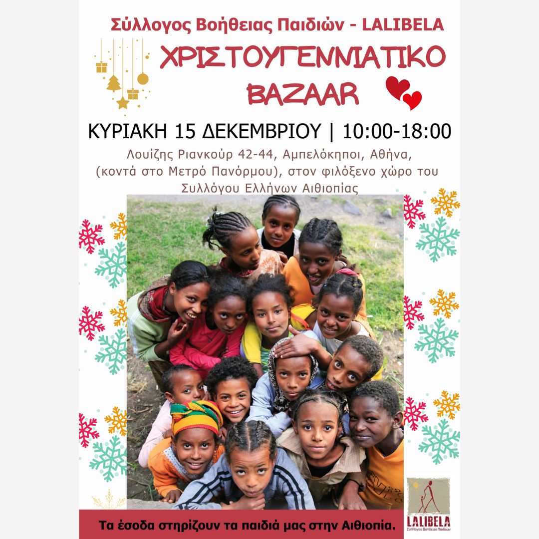
📍 Hellenic-Ethiopian Association, Louise Riencourt 42-44, Ampelokipi
🕒 10:00 AM – 6:00 PM
This bazaar offers a unique selection of Christmas decorations, handmade sweets, accessories, and ethnic gifts from Ethiopia. Proceeds support vulnerable children in Lalibela.
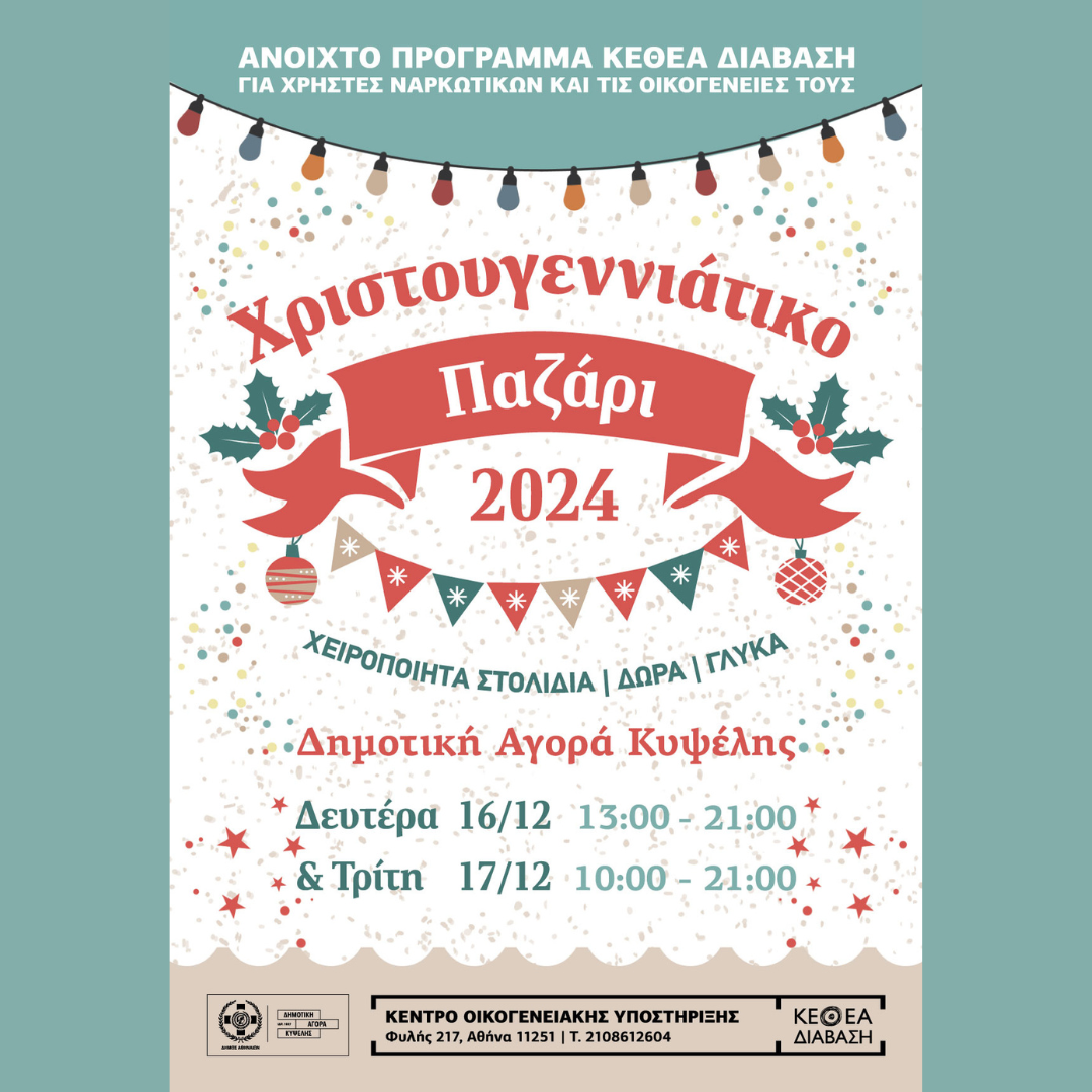
📍 Kypseli Municipal Market
🕒 16 December: 13:00 AM – 9:00 PM; 17 December: 10:00 AM – 9:00 PM
Support this rehabilitation program by purchasing handmade gifts, ornaments, and delicious sweets crafted by its members.
Moving Made Simple - A Guide to Domestic & International Removals

When you get in touch with us, we’ll happily connect you with trusted partners who can help your move unfold with ease, by offering this kind of support.
-
Specialized Packing: Using high-quality materials to protect fragile or high-value items.
-
Logistics & Customs: Handling all transportation and complex customs formalities.
-
Loading & Delivery: Professional handling from your old front door to your new one.
-
Dedicated Coordination: A consultant to oversee the entire process, from initial planning to post-move follow-up.
- Start planning early: Early preparation is the most effective way to reduce stress. Begin outlining your move weeks—or even months—in advance. This gives you time to gather documents, compare service providers, and avoid last‑minute surprises.
- Create a moving checklist: A detailed checklist keeps everything on track. Common items include: notifying landlords or property managers, scheduling utility disconnections and reconnections, organizing important documents, booking movers or transportation, preparing pets, children, or special items for the move. A checklist helps you stay organized and ensures nothing slips through the cracks.
- Research moving companies: If you plan to hire professionals, take time to compare: experience and reputation, insurance coverage, packing and handling standards, customer reviews, availability for your preferred dates. For international moves, look for companies familiar with customs procedures and long‑distance logistics.
- Understand custom requirements (for international moves): Cross‑border relocations involve additional steps. Depending on your destination, you may need to prepare an inventory lists, customs declarations, certificates for pets, vehicle import documents, restrictions on certain items. Understanding these requirements early helps avoid delays at borders or ports.
- Declutter before packing: Moving is the perfect opportunity to simplify. Donate, sell, or recycle items you no longer need. Fewer belongings mean lower moving costs, easier packing, and a fresh start in your new home.
- Pack smart: Use sturdy boxes, label everything clearly, and keep essential items (documents, medications, chargers, valuables) in a separate “first‑day box.” If you’re packing fragile or valuable items, consider professional packing services for added protection.
- Consider Insurance: Accidents are rare but possible. Insurance can for example cover household goods, vehicles, fine art or antiques, or any high‑value items. Understanding your coverage gives you peace of mind throughout the journey.
Get in touch with us, and we’ll help connect you with experienced professionals who can ensure your relocation is handled with care, efficiency, and attention to detail!
iforU Mentoring Network
iforU is a non-profit organization for the empowerment and support of young women entrepreneurs through Mentoring & Networking. We are targeted to women that have recently started their business or have had their own business for a while but are ready to take it to the next level. Our vision is to see women in Greece achieve their full potential in business, playing an important part in the new order of things.
Our Tools
The Mentoring Program:
There comes a time when an anthill may look like a molehill to most of us; that's when you need someone to take you by the hand and show you how it's done. Our mentors are seasoned entrepreneurs and educators whose experience and insights will help you see things in a different light, encouraging you in your everyday quest for success.
Conferences, seminars, workshops and other offline activities:
Starting with our first conference in May 2012, iforU offers a variety of opportunities for learning, sharing and networking, in Greece and abroad. Our relationship and involvement with social and professional networks on a local and international level allows us to share knowledge and expertise with women entrepreneurs around the globe and to utilize it for the empowerment of young female entrepreneurs in Greece.