
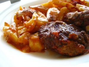
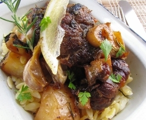
The focus of Greek cooking is on the vegetables, breads and meats and the philosophy seems to be bringing out the natural flavor of these things rather than hide it or disguise it with spices.
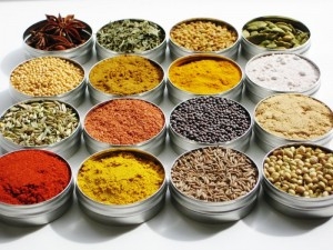
So lets begin with the basics, and the most basic is alati (salt). Greek cooking relies heavily on salt to bring out the flavor of meat, fish and vegetables and most of the salt used is from the sea. There are many places in Greece where salt is harvested on flat plains by the sea and Greek sea-salt is of a high quality. Next is piperi (pepper) which like salt is found on every table and is usually the normal black pepper that you eat at home. Some chefs, notably Aglaia Kremezi, use Aleppo Pepper which adds an interesting flavor to the food but if this was common in any period of Greek history it is not now unless you are lucky enough to be invited to her house for lunch.
Herbs
Rigani (oregano) is used a lot in Greek cooking appearing in most meat dishes, baked vegetables, sauces and of course on Greek salads. This is the most widely used herb. Among the other herbs which grow on the hillsides of the Greek mainland and the islands dendrolivano (rosemary) is used sparingly, in fact I can think of only two recipes. One is a vinegar sauce for fish that my mother used to make and the other is with lamb and roast potatoes though this may be more common among the Greeks I know than those of the general population. Thymari (thyme) is used in some meat dishes and for flavoring some olives as well as some of the best Greek honey. Faskomilo (sage) can be smelled all over the mountains and is used in a tea. Diosmos (mint) is used to flavor keftedes (meatballs) and in some pies and salads. Vassilikos (basil) which is one of my favorite herbs is actually not eaten in Greece though you will see it grown ornamentally or for good luck in gardens, apartments, rooftops, restaurants and even on boats. Anitho (dill) is used in pitas (pies), salads and dolmadas. Maidanos (parsley) is used as a garnish as well as in some meat and vegetable dishes. Dafnofila (bay leaves) are used in some soups and stews. Selino is actually wild celery and is used in some stews, particularly the hirino me selino which is served in the winter.
Spices
Garifalo (cloves) are an important ingredient in stifado and is also used in breads and sweets. Kumino (cumin) is used in soutzoukakia, the spicey meatballs served in tomato sauce. Sousami (sesame seeds) are used on breads and in halva and with honey to make a sweet called pasteli. Kanela (cinnamon) is used in many sauces and desserts and is sprinkled on apples for a dessert after a big meal.
In the Athens central market there are venders selling herbs and spices on the street and there are several shops that specialize in them, the best known being Elixer on Evripidou Street right near the corner of Athinas Street.
By Matt Barrett


 In some souvlaki shops the meat is skewered and sometimes you can get ground beef, which is generally known as beefteki. In some upscale souvlaki shops you can get chicken souvlakis and even swordfish souvlakis (Very rare. I think there is a place next to MacDonalds at Syntagma where I saw it). Souvlaki comes in wax paper which keeps it all together and you eat it like you are peeling a banana. It can be messy but who cares?
  Souvlaki is strong and unless you are the most militant vegetarean you should not leave Greece without trying one.(You can get them without meat too.)
  next door. His name is Spiro and his picture is everywhere, happily posing with famous people, Greeks and international. In fact it is my personal goal to have my picture up there with Spiro one day since it is sort of Greece's answer to Gruman's Chinese Theater. So if you want to do a little active campaigning for me feel free to ask Spiro or the waiter when will he have Matt Barrett in one of his pictures. Generally you have to be a little more famous than I am but with the help of some of my readers maybe we can speed up the timetable and ensure my immortality.